

![]()
What Lies Beneath Bridgewater
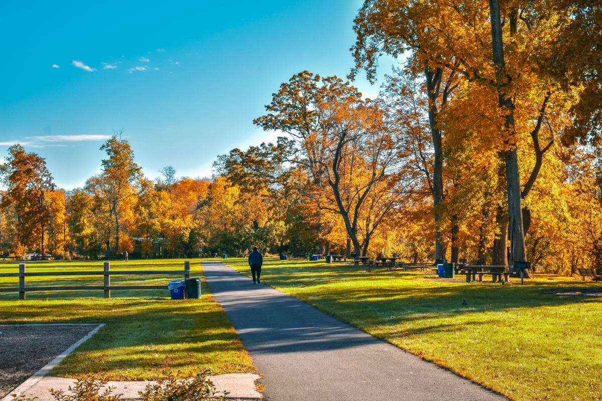
Roads That Were Never Built, They Were Remembered
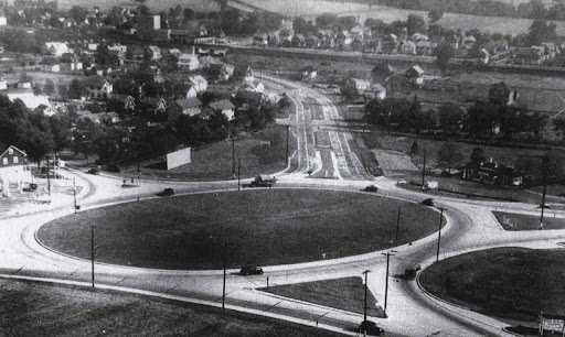
Somerville Circle
Bridgewater was formally established in 1749, but its functional history starts much earlier with Lenape movement corridors. These were not random trails. They followed elevation ridges that naturally avoided flood-prone ground, determined by water access and terrain stability. Several modern roads still mirror those exact choices, without most residents ever realizing it. Certain streets feel “naturally placed” rather than engineered because, in the most literal sense, they were.
No one has a complete record of all pre-colonial routes that crossed the area. Archaeological evidence is fragmentary, so the full extent of indigenous movement through Bridgewater is still partially inferred rather than confirmed. What survives is embedded in the land itself.
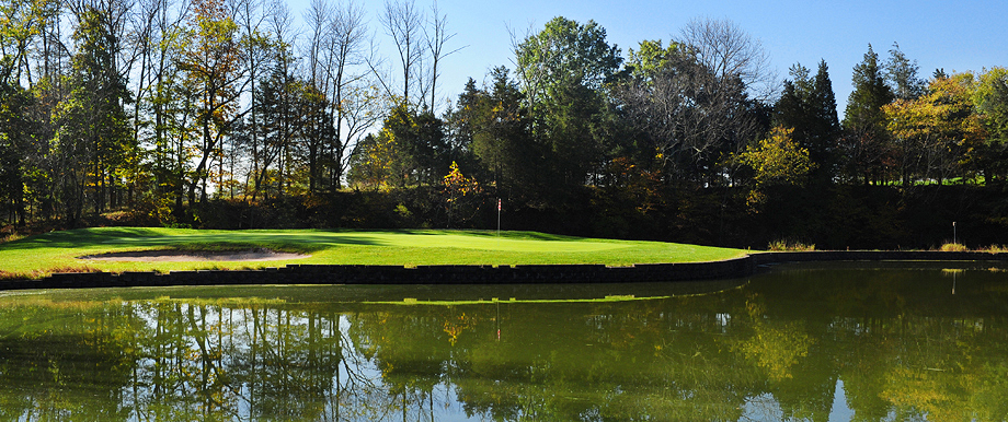
The Lenape word for the Raritan River translates roughly to “the forked stream.” They named the water system for its branching behavior. The North and South Branches of the Raritan converge at the border of Bridgewater Township to form the main Raritan River. The Lenape called this exact meeting point “Tucca-Ramma-Hacking,” meaning the flowing together of waters. The river doesn’t just pass through Bridgewater. It was born there. It is New Jersey’s largest watershed and a major water supply. A water filtration plant in Somerset draws water at the confluence of the Raritan and Millstone Rivers, providing an average of 132 million gallons of drinking water per day. The Raritan collects water from 6 New Jersey counties and 49 municipalities. It is the largest watershed in the most densely populated state in the nation.
Washington’s Invisible Supply Chain Ran Through Here
During the American Revolutionary War, Bridgewater’s importance was logistical rather than dramatic. While not a battlefield, it functioned as a critical movement corridor between Washington’s encampment zones at Morristown and the Raritan River crossings.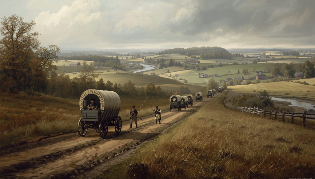
Troops passed through continuously because of its position between those two strategic anchors. The reason Bridgewater worked logistically was the same reason the Lenape used it before: geography that connects rather than obstructs.
The Continental Army under George Washington constantly struggled to move food, weapons, and supplies. They didn’t have a strong centralized system, roads were rough, and British forces controlled key areas, especially around New York City. The Raritan River in New Jersey was a natural obstacle. Moving wagons, cannons, and supplies across it was tricky, especially if British patrols could spot or intercept them.
The army was often on the verge of starvation or running out of ammunition. Logistics, not just battles, were a major threat to survival. Here in Bridgewater, lesser-known farmsteads were used for supply staging, keeping the army fed, armed, and moving rather than for actual combat. These sites never received formal historical designation. Their role survives mostly in scattered records rather than bronze markers. Some of those farmstead locations still exist as private land today, carrying history that is not publicly acknowledged.
Why Your Property Line Makes No Geometric Sense
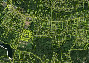
app.regrid.com/us/nj/somerset/bridgewater
Early land division in Bridgewater created a structural fingerprint that is still visible on every survey map today. Colonial land patents carved the township into irregular parcels based on natural features like streams, tree lines, and ridge edges, rather than straight survey grids. That pattern still directly influences property boundaries, which is why certain lots appear oddly shaped or inconsistent in size compared to neighboring communities.
Property lines in some sections still follow 18th-century boundaries. Easements and legacy access paths sometimes exist without obvious surface indicators, embedded in deeds and title chains rather than visible on the ground. These can affect development or landscaping plans in ways that aren’t obvious until work begins.
Beyond the paperwork, there are small, largely undocumented cemetery plots scattered in wooded or private areas from the 18th and early 19th centuries. These were family plots rather than formal cemeteries. They are not publicly marked, formally maintained, or widely mapped. Some only resurface during land surveys. In rare cases, discoveries happen during construction or land modification. This occurs not just in Bridgewater but in many heavily Revolutionary-era-occupied towns.
Two Geological Worlds Colliding Beneath One Township
Bridgewater is geographically unusual for suburban New Jersey. It sits at the meeting point of multiple ancient geological provinces.
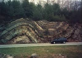
Fold in the Green Pond Formation Rt 23 North Newfoundland
The land beneath shifts from Newark Basin sedimentary rock, formed from ancient lake beds, to older, harder formations. That boundary is not a clean line. It meanders through the township, which is why soil stability and drainage vary sharply even over short distances.
Some areas have stable bedrock close to the surface. Others sit on deeper sediment layers that behave differently under load and moisture. Expansive soils in certain pockets shift with moisture changes over time, creating subtle structural movement that is not obvious during a standard viewing. Foundation behavior, basement moisture, and long-term settling are all quietly shaped by which geological zone a given parcel sits on. Subsurface conditions are not uniform. Even within a single property, soil composition can vary enough to affect drainage or foundation performance in ways that standard inspection does not capture.
The Township That Floods by Neighborhood, Not by Map
Bridgewater has one of the more complex watershed overlaps in New Jersey. It feeds into the Raritan River system, but multiple micro- watersheds exist within the township itself, splitting water flow in directions that don’t always match intuition. Two nearby neighborhoods can experience completely different flood risks even at similar elevations, and that difference may not appear on standard FEMA flood maps.
Flooding here is not only river-driven. Saturation from heavy rainfall combined with clay-heavy soils in certain zones prevents proper drainage and creates what might be called invisible flood zones, areas that accumulate water from the ground up rather than from overflow. Older structures built before modern floodplain mapping may sit in areas now recognized as higher risk than when they were constructed.
Areas near the Raritan River and its tributaries can be noticeably cooler and more humid at night, while slightly elevated inland zones retain heat. This microclimate difference creates mold risk variation, affects lawn health, and produces measurable differences in exterior wear on buildings over time. Frost timing can differ by a few critical days within short distances, relevant for anyone serious about landscaping or gardening.
How a Farm Township Became a Corporate Address Overnight
 Agriculture dominated Bridgewater for over two centuries. Then, in the mid-to-late 20th century, the township transitioned rapidly into a corporate suburban hub in a transformation that was remarkably compressed in historical terms. Large office parks were deliberately placed near major highway access points, Routes 22, 202, and 206, and Interstate 287, to capture commuter flow. This reshaped the township into a commuter-centered economy almost overnight compared to its long farming past.
That rapid expansion created a daytime population surge that does not match residential counts. Infrastructure was built in phases across different eras, meaning some neighborhoods have modern drainage and utilities while others rely on older systems that were retrofitted rather than replaced. Office park development also dramatically increased impervious surfaces, parking lots, roads, and rooftops, which changed how water moves through the township. Runoff today behaves differently than it did when fields absorbed rainfall.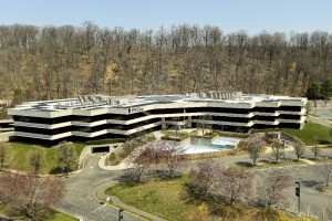
There are likely undocumented historical artifacts still buried in undeveloped or previously farmed land. Because much of the township was cultivated for centuries, objects were moved, lost, or reburied without record. The long-term ecological balance of the watershed remains uncertain as suburban development continues to alter runoff patterns, and the effectiveness of mitigation systems over decades is still being studied.
Why People Who Move Here Tend to Stay
Bridgewater consistently ranks among the top townships in Somerset County, and New Jersey broadly, for school performance, safety, and overall livability. These aren’t marketing claims. They are reflected in long-term residency patterns. Households that arrive here often do not leave, which keeps inventory tight and values relatively stable over time compared to neighboring communities.

The school district draws particular attention. Bridgewater-Raritan Regional School District serves students from kindergarten through twelfth grade and has maintained strong academic outcomes for decades. The high school consistently places students into competitive universities, and the district offers specialized programs in STEM, performing arts, and advanced coursework that typically require a much larger or wealthier district to sustain.
A Place That Works for Daily Life Without Demanding It
One of Bridgewater’s least-discussed advantages is how little friction it creates for everyday living. Major retail, culture, healthcare, and dining options are distributed across the township in a way that rarely requires leaving for routine needs. The Bridgewater Commons mall anchors retail, but the broader commercial corridor along Routes 22 and 202 covers groceries, medical offices, gyms, restaurants, and professional services without the congestion typical of denser suburban towns.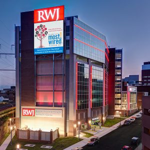
Robert Wood Johnson University Hospital Somerset is located within the township, a full-service hospital with specialist services, rare for a suburban township of this size.

What Conventional Due Diligence Doesn’t Tell You
Bridgewater appears conventional on the surface. What separates an ordinary transaction from an informed one is understanding the invisible systems underneath: old land divisions that still dictate lot shapes, micro-watersheds that make flood risk hyperlocal, a geological boundary that determines foundation behavior, and a development history layered over centuries-old patterns in a very short span of time.
But those complexities exist within a township that has, by most practical measures, delivered consistently for the people who chose it. Strong schools, stable values, good infrastructure, and genuine daily convenience are not marketing language here. They are the reason turnover stays low, and demand stays steady. Understanding both sides of that picture is what makes a decision here a real one.


